Electronics
The best fish finder for walleye: mapping first, then imaging
Walleye fishing is structure fishing. The contour map matters more than the fish arch.
By Sawyer V. · Last updated · How we pick
The short answer
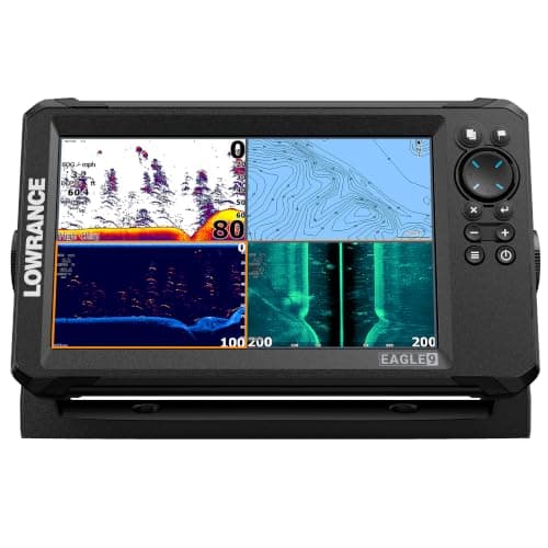
Buy mapping before imaging. The Lowrance Eagle 9 publishes C-MAP inland charts for 17,000+ US lakes on a 9 in 1000-nit screen; the Humminbird HELIX 5 DI publishes Down Imaging at 455 kHz with built-in GPS. Walleye sit on breaklines, humps and points, and finding those is a chart problem.
Reel & Rig earns a commission from qualifying purchases made through links on this page, at no extra cost to you. It does not change which gear we pick or what we say about it. Full disclosure.
Quick picks
| # | Product | Best for | Price |
|---|---|---|---|
| 1 | Best walleye fish finder Lowrance Eagle 9 with TripleShot HD 9 in IPS at 1024 x 600 and 1000 nits, CHIRP with DownScan and SideScan to 600 ft per side, C-MAP inland charts. | Finding structure fast on big water you do not know | $749.99 · Check price on Amazon #ad how this is funded · price as of October 12, 2026 |
| 2 | 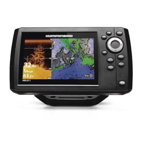 Best value for structure Humminbird HELIX 5 CHIRP DI GPS G3 5 in widescreen at 800 x 480, Dual Spectrum CHIRP 83/200 kHz with Down Imaging at 455 kHz, built-in GPS and AutoChart. | Jigging breaklines and reading what is on the bottom | $375.66 · Check price on Amazon #ad how this is funded · price as of October 12, 2026 |
| 3 | 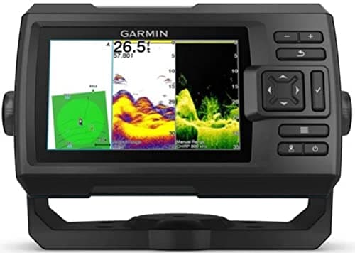 Best for mapping your own lake Garmin STRIKER Vivid 5cv 5 in display with 77/200 kHz traditional and 455/800 kHz ClearVu CHIRP, and Quickdraw Contours mapping at 1 ft contours. | Small or uncharted waters, and anglers who fish one lake repeatedly | $334.99 · Check price on Amazon #ad how this is funded · price as of October 12, 2026 |
Why walleye are a mapping problem
Walleye relate to structure with unusual consistency. Breaklines, points, humps, the edge of a weed flat, the lip of an old creek channel — find those and you have found where walleye will be at some point in the day.
They also move between them on a schedule: shallow at dawn and dusk, deeper in bright daylight. Which means the same lake has a morning spot and a midday spot, and both are features on a contour map.
That is why the buying advice inverts the usual order. On a crappie unit you care about seeing fish in brush. On a walleye unit you care about seeing the bottom shape, and the fish marks are a bonus.
The three, side by side
| Figure | Eagle 9 | HELIX 5 DI | STRIKER Vivid 5cv |
|---|---|---|---|
| Display | 9 in, 1024 x 600, 1000 nits | 5 in, 800 x 480 | 5 in |
| Imaging | DownScan and SideScan | Down Imaging 455 kHz | ClearVu 455/800 kHz |
| Mapping | C-MAP, 17,000+ lakes | AutoChart Live | Quickdraw, 1 ft contours |
| Published draw | 640 mA at 12 V | Not published | Not published |
Charts or build your own
Pre-loaded charts are instant and cover the big, popular lakes. If you fish named walleye water, C-MAP or Humminbird Basemap has it and you start with a map on day one.
Self-mapping — Quickdraw or AutoChart Live — is slower and better. You end up with finer contours than any commercial chart on the specific water you fish, and it works on lakes nobody has ever charted.
The ideal is both, which is why a charted unit that also self-maps is the thing to look for. Our maps and charts page covers the formats.
Reading a walleye on the screen
They are frequently not arches. A walleye sitting on the bottom on a breakline shows as a slight thickening of the bottom line rather than a distinct mark, because it is not moving through the cone.
This is where Down Imaging earns its money. A fish hard on the bottom separates from the bottom on an imaging channel far more clearly than on traditional sonar.
Our reading a fish finder page covers the returns in general, and our sonar types page covers why imaging and traditional sonar show different things.
Mounting it on a walleye boat
Most walleye boats are aluminum, and the transducer needs to sit in clean water away from rivet lines and strakes. Our aluminum boat sonar page covers the specifics, and our installation page covers the wiring.
Run the electronics off their own battery rather than the trolling motor’s. Voltage sag when the motor loads up shows up as noise on the screen, exactly when you are trying to read a breakline.
The rest of the setup is on our walleye setup page.
So what do I actually buy?
Charts if you fish big named water, self-mapping if you fish one small lake. Screen size is the third decision and it costs battery.
Lowrance Eagle 9 with TripleShot HD
$749.999 in at 1000 nits with C-MAP and 600 ft SideScan. Finds structure fastest.
#ad how this is funded · price as of October 12, 2026
Humminbird HELIX 5 CHIRP DI GPS G3
$375.66Down Imaging at 455 kHz with AutoChart Live. Reads bottom composition on a breakline.
#ad how this is funded · price as of October 12, 2026
Garmin STRIKER Vivid 5cv
$334.99Quickdraw Contours at 1 ft. Maps your own lake finer than any chart does.
#ad how this is funded · price as of October 12, 2026
The picks, in full
Every card below lists the specs we could read off a published page, the URL they came from, and one honest reason you might not want it.
1. Best walleye fish finder
Lowrance Eagle 9 with TripleShot HD
Lowrance
9 in IPS at 1024 x 600 and 1000 nits, CHIRP with DownScan and SideScan to 600 ft per side, C-MAP inland charts.
C-MAP inland coverage of 17,000+ US lakes is published, and on walleye water that is the feature that finds fish. A contour map shows you every breakline, hump and point on a lake before you have made a single pass, which turns a day of searching into a day of fishing.
A published SideScan range of up to 600 ft per side means one pass covers a 1,200 ft swath. On a big flat where walleye are scattered, that is the difference between covering the structure and sampling it.
9 in at 1024 x 600 and a published 1000 nits is a genuinely readable screen. Walleye fishing happens at dawn and dusk and in flat glare off the water, and brightness is the specification people underestimate.
Published storage of 3,000 waypoints, 100 routes and 100 trails is the other half of it. Walleye spots are small and repeatable, and a unit that remembers 3,000 of them is a multi-season record of your lake.
The drawback
At 11.3 x 6.39 in it is a large unit, and on a small tiller boat there may not be a flat surface that takes it. The published 640 mA draw at full backlight is also the highest here — over a ten-hour day that is 6.4 Ah, which is most of a small battery. And C-MAP inland coverage is broad rather than universal; a small local lake may simply not be charted.
Published specs
- Display
- 9 in IPS, 1024 x 600, 1000 nits
- Transducer
- TripleShot HD with FishReveal
- Sonar
- CHIRP, DownScan Imaging, SideScan
- SideScan range
- Up to 600 ft per side
- Mapping
- C-MAP inland, 17,000+ US lakes
- Storage
- 3,000 waypoints / 100 routes / 100 trails
- Dimensions
- 11.30 x 6.39 x 3.54 in
- Weight
- 1.98 lb
- Power draw
- 640 mA @ 12 V, full backlight
- Water rating
- IPX7
Specs read from L&M Fleet Supply — Lowrance Eagle 9 with TripleShot HD Transducer.
#ad how this is funded · price as of October 12, 2026
2. Best value for structure
Humminbird HELIX 5 CHIRP DI GPS G3
Humminbird
5 in widescreen at 800 x 480, Dual Spectrum CHIRP 83/200 kHz with Down Imaging at 455 kHz, built-in GPS and AutoChart.
Down Imaging published at 455 kHz is what tells you whether a breakline is rock, gravel or mud. Walleye relate to bottom composition as much as to depth, and standard sonar shows you the depth without telling you what the bottom is made of.
Dual Spectrum CHIRP at 83/200 kHz with published cone angles of 20, 42 and 60 degrees gives you a choice between a narrow beam for detail directly below and a wide one for coverage. Vertical jigging wants the narrow one.
Built-in GPS with AutoChart Live means you can map a lake yourself as you fish it. On the small, uncharted waters where a lot of walleye fishing happens, that is more useful than a pre-loaded chart of somewhere else.
4,000 W peak-to-peak and 500 W RMS published with a 1,200 ft sonar depth is far more than any inland walleye lake asks for, which means the return is strong and clean at the depths you actually fish.
The drawback
5 in is small for running sonar and Down Imaging side by side, which is exactly how you would want to use it — the split screen is cramped. There is no SideScan, so finding structure means driving over it rather than scanning beside it. And Humminbird publishes a 350 ft Down Imaging depth against 1,200 ft for sonar, which is irrelevant inland but shows imaging is the shallower tool.
Published specs
- Display
- 5 in widescreen, 800H x 480V, 16-bit color
- Transducer
- XNT 9 HW DI T
- Sonar
- Dual Spectrum CHIRP 83/200 kHz (75-155 / 130-250 kHz)
- Down Imaging
- 455 kHz (420-520 kHz)
- Coverage
- 20, 42 and 60 deg @ -10 dB
- Max depth
- 1,200 ft sonar / 350 ft Down Imaging
- Power output
- 4,000 W peak-to-peak / 500 W RMS
- Mapping
- Built-in GPS, AutoChart Live (8 h), LakeMaster/Navionics ready
- Dimensions
- 7.55 W x 4.64 H x 3.3 D in (gimbal)
Specs read from L&M Fleet Supply — Humminbird HELIX 5 CHIRP DI GPS G3.
#ad how this is funded · price as of October 12, 2026
3. Best for mapping your own lake
Garmin STRIKER Vivid 5cv
Garmin
5 in display with 77/200 kHz traditional and 455/800 kHz ClearVu CHIRP, and Quickdraw Contours mapping at 1 ft contours.
Quickdraw Contours published at 1 ft resolution is the feature to buy this for. It builds a contour map of the water as you drive over it, at a finer resolution than most published charts.
That matters on walleye water specifically, because the structure that holds fish is often a two-foot rise on an otherwise flat bottom. A chart with 5 ft contours does not show it; a map you built at 1 ft does.
ClearVu published at 455/800 kHz and 500 W gives the high-detail bottom picture, and the traditional 77/200 kHz channel gives the fish marks. Running them together is the standard walleye arrangement.
Published transom and trolling-motor mounts mean the transducer goes where it reads cleanly, which on a small walleye boat is usually the trolling motor rather than behind a rivet line.
The drawback
There are no pre-loaded charts at all, so a lake you have never driven is blank until you map it — which is several hours of work before it is useful. The 5 in screen is the same constraint as the HELIX, there is no SideScan, and Garmin does not publish a current draw figure, which matters on the small battery a walleye boat usually carries.
Published specs
- Display
- 5 in color
- Transducer
- GT20-TM, 20 ft cable with temperature sensor
- Traditional sonar
- 77/200 kHz, 500 W
- ClearVu sonar
- CHIRP 455/800 kHz, 500 W
- Max depth
- 1,900 ft traditional / 750 ft ClearVu
- Mapping
- Quickdraw Contours, 1-ft contours
- Mounts
- Transom and trolling motor
Specs read from Fish307 — Garmin STRIKER Vivid 5cv with GT20-TM Transducer.
#ad how this is funded · price as of October 12, 2026
Questions people actually ask
What fish finder is best for walleye?
One with good mapping. Walleye relate to breaklines, humps and points, so a contour chart or a self-mapping feature finds them faster than any fish-marking capability does.
Do I need side imaging for walleye?
It helps on big flats where fish are scattered — a published 600 ft per side covers a 1,200 ft swath in one pass. On smaller water, Down Imaging plus a good chart does the job for much less.
Why do walleye not show as arches on sonar?
Because a fish sitting hard on the bottom does not pass through the cone, so it shows as a thickening of the bottom line rather than a distinct mark. Down Imaging separates bottom-hugging fish far more clearly.
Is self-mapping better than pre-loaded charts for walleye?
It is finer. Quickdraw publishes 1 ft contours, which shows the two-foot rise that holds fish where a 5 ft commercial contour does not. Pre-loaded charts are instant; self-mapping is better on the water you fish most.
Read next
Prices on this page come from the retailer at request time and change without notice. If we cannot get a live one we say “check price” rather than show you a number that has gone stale. How we pick.