Electronics
The best fish finders for freshwater
Compared on beam angle and power draw rather than screen size, because on a small boat those are the numbers that decide what you can actually run.
By Sawyer V. · Last updated · How we pick
The short answer
For a freshwater lake, a 5-inch unit with 2D CHIRP sonar, built-in GPS and a transom-mount transducer is the right answer. Depth rating is nearly irrelevant — a unit rated to 1,200 ft and one rated to 600 ft perform identically on a 40-foot lake. The specs that matter are coverage angle (how much water the cone sees at your depth) and power draw (what your battery can run).
Reel & Rig earns a commission from qualifying purchases made through links on this page, at no extra cost to you. It does not change which gear we pick or what we say about it. Full disclosure.
Quick picks
| # | Product | Best for | Price |
|---|---|---|---|
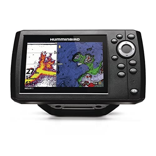
| 1 | Best overall Humminbird HELIX 5 CHIRP GPS G3 800x480 on 5 inches, a 60-degree wide cone, 500 W RMS and 615 mA draw. Every relevant spec is published. | A 12-16 ft boat on inland lakes | $341.56 · Check price on Amazon #ad how this is funded · price as of October 19, 2026 |
| 2 | 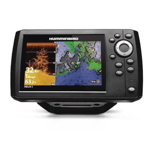 Best for reading structure Humminbird HELIX 5 CHIRP DI GPS G3 Adds 455 kHz down imaging to the same 5-inch screen, reading to 350 ft on DI against 1,200 ft on 2D. | Seeing what the brush pile actually looks like | $375.66 · Check price on Amazon #ad how this is funded · price as of October 19, 2026 |
| 3 | 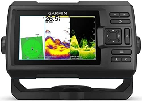 Best mapping for unmapped water Garmin STRIKER Vivid 5cv Quickdraw Contours draws your own 1-ft contour map as you drive, which beats a pre-loaded chart on water that has none. | A local lake nobody has charted | $334.99 · Check price on Amazon #ad how this is funded · price as of October 19, 2026 |
| 4 | 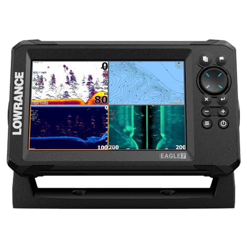 Best pre-loaded mapping Lowrance Eagle 7 with TripleShot HD C-MAP charts for 17,000+ US lakes on a 7-inch 1000-nit screen, with SideScan reaching 600 ft per side. | Fishing lots of different lakes | $599.99 · Check price on Amazon #ad how this is funded · price as of October 19, 2026 |
| 5 | 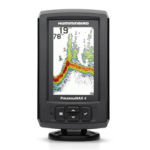 Cheapest one worth buying Humminbird PiranhaMAX 4 4.3 inches, 200/455 kHz, 600 ft, 300 W RMS — no GPS, and honest about it. | A jon boat, a canoe, or a first screen | $135.02 · Check price on Amazon #ad how this is funded · price as of October 19, 2026 |
Coverage angle is the spec nobody puts on the box
Sonar radiates in a cone. The published beam angle tells you how wide that cone is, and simple geometry turns it into how much water you are actually looking at.
The circle a cone covers at a given depth is roughly 2 × depth × tan(angle/2). That is the arithmetic behind the table below, and it is worth doing once because the results are more dramatic than people expect.
| Beam angle | At 10 ft | At 20 ft | At 40 ft | Where it appears |
|---|---|---|---|---|
| 16° | ~2.8 ft | ~5.6 ft | ~11 ft | PiranhaMAX 4, 455 kHz |
| 20° | ~3.5 ft | ~7 ft | ~14 ft | HELIX 5, narrow |
| 28° | ~5 ft | ~10 ft | ~20 ft | PiranhaMAX 4, 200 kHz |
| 42° | ~7.7 ft | ~15 ft | ~31 ft | HELIX 5, medium |
| 60° | ~11.5 ft | ~23 ft | ~46 ft | HELIX 5, wide |
In shallow water a narrow cone shows you almost nothing. That is the honest reason a $500 unit outperforms a $120 one on a fifteen-foot lake, and it has nothing to do with screen size.
Depth rating is the most-quoted irrelevant spec
These units publish maximum depths from 600 ft to 1,900 ft. A typical inland lake is under 60. Every unit here has an order of magnitude more depth capability than you will ever use, and the number appears prominently on every box because it is a big number.
Where it does matter: down imaging and side imaging have much lower depth limits than 2D sonar, and those limits can be real. The HELIX 5 DI publishes 1,200 ft on 2D and 350 ft on down imaging. On a deep reservoir that gap is worth knowing about.
Power draw decides what you can run
On a boat with a cranking battery, never a consideration. On a kayak or a small jon boat with a sealed pack, it decides everything.
| Unit | Draw | Input | Day on a 7 Ah pack? |
|---|---|---|---|
| Lowrance Eagle 7 | 550 mA | 12 V DC | Yes, comfortably |
| Humminbird HELIX 5 | 615 mA | 10.8–20 V DC | Yes |
| Lowrance Eagle 9 | 640 mA | 10.8–17 V DC | Yes |
| Humminbird PiranhaMAX 4 | Not published | 10.8–20 V DC | Almost certainly |
Note that the largest screen here draws the least current. Screen size and power draw are not the same axis, and assuming they are will lead you to buy a smaller unit for no reason.
What we could not verify
Several things, and they are worth listing plainly.
- Weight for the HELIX 5 and the PiranhaMAX 4 — not published on the sources we could reach.
- Display resolution, weight and waypoint capacity for the STRIKER Vivid 5cv on the retailer page we cite.
- Frequency ranges and per-sonar depth limits for the Lowrance TripleShot HD transducer.
- Power draw for the PiranhaMAX 4.
And two things nobody publishes that matter a great deal: how a screen reads in direct sunlight beyond a raw nit figure, and how well the menus are organized. We have not run these units, so we do not know.
What we would skip
Any unit whose listing leads with screen size and does not publish beam angles. A maker who tells you the display is seven inches and will not tell you what the cone sees has chosen which specification flatters the product.
The picks, in full
Every card below lists the specs we could read off a published page, the URL they came from, and one honest reason you might not want it.
1. Best overall
Humminbird HELIX 5 CHIRP GPS G3
Humminbird
800x480 on 5 inches, a 60-degree wide cone, 500 W RMS and 615 mA draw. Every relevant spec is published.
The published coverage figures are what put this first: 20, 42 and 60 degrees at −10 dB. That 60-degree wide mode is the one that matters in shallow water. In twelve feet of water a 60-degree cone sees a circle roughly fourteen feet across; a 16-degree cone sees about three. On a typical inland lake that difference is the whole game.
Dual Spectrum CHIRP gives you three published frequency bands — narrow 180–240 kHz, wide 140–200 kHz, full 150–220 kHz — which is a genuine sharpness-versus-coverage control rather than a marketing mode.
4,000 W peak-to-peak and 500 W RMS, reading to 1,200 ft on the included XNT 9 HW T transducer. Built-in GPS with Humminbird Basemap and AutoChart Live with eight hours of recording, storing 2,750 waypoints, 45 routes and 50 tracks.
615 mA draw at 10.8–20 VDC means a 7 Ah battery runs it all day with margin. Gimbal dimensions are 7.55 × 4.64 × 3.3 in.
The drawback
No down imaging. If you want a near-photographic picture of structure directly beneath the boat, that is the DI model rather than this one — and this unit's weight is not published anywhere we could find.
Published specs
- Display
- 5 in, 800H x 480V color TFT
- Transducer
- XNT 9 HW T
- Sonar
- Dual Spectrum CHIRP: narrow 180-240, wide 140-200, full 150-220 kHz
- Coverage
- 20, 42 and 60 deg @ -10 dB
- Max depth
- 1,200 ft standard (3,000 ft with optional 50 kHz)
- Power output
- 4,000 W peak-to-peak / 500 W RMS
- Mapping
- Humminbird Basemap, AutoChart Live (8 h)
- Waypoints
- 2,750 waypoints / 45 routes / 50 tracks
- Dimensions
- 7.55 W x 4.64 H x 3.3 D in (gimbal)
- Power draw
- 615 mA
Specs read from Rogers Sporting Goods — Humminbird HELIX 5 CHIRP GPS G3.
#ad how this is funded · price as of October 19, 2026
2. Best for reading structure
Humminbird HELIX 5 CHIRP DI GPS G3
Humminbird
Adds 455 kHz down imaging to the same 5-inch screen, reading to 350 ft on DI against 1,200 ft on 2D.
Down imaging runs at a much higher frequency than 2D sonar — a published 455 kHz in a 420–520 kHz band — and trades depth for detail. The published numbers show that trade cleanly: 1,200 ft on traditional sonar, 350 ft on down imaging.
What you get for it is a picture rather than an interpretation. On 2D sonar a brush pile is a fuzzy mound you learn to read; on down imaging it is recognizably branches. For someone learning to read a screen, that translation is genuinely valuable.
Same 5-inch 800 × 480 widescreen with 16-bit color, same Dual Spectrum CHIRP at 83/200 kHz (75–155 / 130–250 kHz), same 20/42/60-degree coverage, same 4,000 W peak-to-peak and 500 W RMS. The transducer changes to an XNT 9 HW DI T.
The drawback
Down imaging only looks straight down, in a narrow slice. It does not help you find fish — it helps you understand what you have already found. If you are trying to cover water, side imaging is the feature you actually want.
Published specs
- Display
- 5 in widescreen, 800H x 480V, 16-bit color
- Transducer
- XNT 9 HW DI T
- Sonar
- Dual Spectrum CHIRP 83/200 kHz (75-155 / 130-250 kHz)
- Down Imaging
- 455 kHz (420-520 kHz)
- Coverage
- 20, 42 and 60 deg @ -10 dB
- Max depth
- 1,200 ft sonar / 350 ft Down Imaging
- Power output
- 4,000 W peak-to-peak / 500 W RMS
- Mapping
- Built-in GPS, AutoChart Live (8 h), LakeMaster/Navionics ready
- Dimensions
- 7.55 W x 4.64 H x 3.3 D in (gimbal)
Specs read from L&M Fleet Supply — Humminbird HELIX 5 CHIRP DI GPS G3.
#ad how this is funded · price as of October 19, 2026
3. Best mapping for unmapped water
Garmin STRIKER Vivid 5cv
Garmin
Quickdraw Contours draws your own 1-ft contour map as you drive, which beats a pre-loaded chart on water that has none.
This is a genuinely different philosophy from the Humminbird and Lowrance units. Rather than shipping charts of thousands of lakes, Garmin gives you Quickdraw Contours, which records depth as you drive and builds a one-foot contour map of wherever you actually are.
If your home water is a small local lake nobody has surveyed, that is a much better answer than a pre-loaded chart set that does not include it. If you fish varied, well-charted water, the reverse is true.
The GT20-TM transducer publishes 77/200 kHz traditional at 500 W and CHIRP ClearVu at 455/800 kHz, reading to 1,900 ft traditional and 750 ft on ClearVu. Twenty-foot cable with a built-in temperature sensor, with transom and trolling motor mounting hardware in the box.
The drawback
Quickdraw only maps water you have already driven over, so your first trip to a new lake gives you nothing. And the published spec sheet from this retailer omits display resolution, weight and waypoint capacity, which we would rather have than not.
Published specs
- Display
- 5 in color
- Transducer
- GT20-TM, 20 ft cable with temperature sensor
- Traditional sonar
- 77/200 kHz, 500 W
- ClearVu sonar
- CHIRP 455/800 kHz, 500 W
- Max depth
- 1,900 ft traditional / 750 ft ClearVu
- Mapping
- Quickdraw Contours, 1-ft contours
- Mounts
- Transom and trolling motor
Specs read from Fish307 — Garmin STRIKER Vivid 5cv with GT20-TM Transducer.
#ad how this is funded · price as of October 19, 2026
4. Best pre-loaded mapping
Lowrance Eagle 7 with TripleShot HD
Lowrance
C-MAP charts for 17,000+ US lakes on a 7-inch 1000-nit screen, with SideScan reaching 600 ft per side.
If you fish varied water, pre-loaded charts are worth real money and this is the most generous set here: C-MAP embedded inland charts covering more than 17,000 American lakes, upgradeable to C-MAP Discover.
The screen is the other reason: 7 inches at 800 × 480 with a published 1,000 nits of brightness and 80-degree viewing angles top/bottom and left/right. Brightness is the spec that decides whether a screen is readable in direct sun, and it is published far less often than it should be.
The TripleShot HD transducer combines CHIRP, DownScan Imaging and SideScan, with published SideScan reach of up to 600 ft either side. Draw is 550 mA at 12 VDC with the backlight on full, which is the lowest here despite the larger screen. Dimensions 8.89 × 5.5 × 3.48 in, operating range 5 to 131 °F.
The drawback
Lowrance does not publish frequency ranges or maximum depth per sonar type for the TripleShot HD on this listing, and it does not publish waypoint capacity. Those are basic figures and their absence is genuinely annoying.
Published specs
- Display
- 7 in, 800 x 480, 1000 nits
- Viewing angle
- 80 deg top/bottom, 80 deg left/right
- Transducer
- TripleShot HD
- Sonar
- CHIRP, DownScan Imaging, SideScan
- SideScan range
- Up to 600 ft per side
- Mapping
- C-MAP inland, 17,000+ US lakes
- Dimensions
- 8.89 x 5.5 x 3.48 in
- Power draw
- 550 mA @ 12 V, full backlight
- Operating temp
- 5 to 131 deg F
Specs read from L&M Fleet Supply — Lowrance Eagle 7 with TripleShot HD Transducer.
#ad how this is funded · price as of October 19, 2026
5. Cheapest one worth buying
Humminbird PiranhaMAX 4
Humminbird
4.3 inches, 200/455 kHz, 600 ft, 300 W RMS — no GPS, and honest about it.
This is a depth-and-fish unit with no GPS and no mapping, and for a lot of small-boat fishing that is genuinely all you need. It tells you how deep you are, what the bottom is doing, the water temperature, and whether there are fish under you.
Published specs: 4.3-inch 272 × 480 display in 256 colors, dual beam at 200/455 kHz with 28 and 16-degree coverage at −10 dB, reading to 600 ft at 200 kHz and 320 ft at 455 kHz. 2,400 W peak-to-peak and 300 W RMS, XNT 9 28 T transom transducer, and a tilt-and-swivel mount.
At 3.91 × 7.34 × 3.62 in on the gimbal it fits somewhere on almost any boat.
The drawback
The 28-degree cone is narrow. In twelve feet of water it sees a circle about six feet across, against roughly fourteen feet for the HELIX 5's 60-degree wide mode. You will drive over fish and not see them. And with no GPS you cannot mark a spot and come back to it, which is the single most useful thing a fish finder does.
Published specs
- Display
- 4.3 in, 272H x 480V, 256-color TFT
- Transducer
- XNT 9 28 T, transom mount
- Sonar
- Dual Beam, 200/455 kHz
- Coverage
- 28 deg and 16 deg @ -10 dB
- Max depth
- 600 ft @ 200 kHz / 320 ft @ 455 kHz
- Power output
- 2,400 W peak-to-peak / 300 W RMS
- Dimensions
- 3.91 W x 7.34 H x 3.62 D in (gimbal)
- Input
- 10.8-20 VDC
Specs read from L&M Fleet Supply — Humminbird PiranhaMAX 4.
#ad how this is funded · price as of October 19, 2026
Questions people actually ask
What is the best fish finder for freshwater lakes?
A 5-inch unit with 2D CHIRP sonar, built-in GPS and a wide beam option. Coverage angle matters far more than screen size on a shallow lake — a 60-degree cone sees roughly a 23-foot circle in 20 feet of water, and a 16-degree cone sees about 5.6 feet.
How deep does a fish finder need to read?
Far less than the box advertises. Typical inland lakes are under 60 feet and every unit in this class reads to at least 600. Depth rating is the most prominently advertised and least relevant specification in freshwater.
Do I need GPS on a fish finder?
It is the single most useful feature after basic sonar, because marking a productive spot and returning to it is what turns a screen into a fishing tool. A unit without GPS tells you what is under you now and nothing about where it was last week.
What is the best fish finder for the money?
A 5-inch CHIRP unit with GPS and mapping sits in the sweet spot. Below that you lose GPS and beam width; above it you are paying for side imaging and screen size, which help on large water and add little on a small lake.
Does screen size matter on a fish finder?
Less than beam angle and mapping. A larger screen is easier to read and lets you split views usefully, but it does not change what the sonar can see. Note that the 7-inch Lowrance Eagle here draws less current than the 5-inch Humminbird.
Read next
Sources
- Rogers Sporting Goods — Humminbird HELIX 5 CHIRP GPS G3 (spec table)
- L&M Fleet Supply — Humminbird HELIX 5 CHIRP DI GPS G3 (spec table)
- L&M Fleet Supply — Humminbird PiranhaMAX 4 (spec table)
- L&M Fleet Supply — Lowrance Eagle 7 with TripleShot HD (spec table)
- Fish307 — Garmin STRIKER Vivid 5cv with GT20-TM transducer
Prices on this page come from the retailer at request time and change without notice. If we cannot get a live one we say “check price” rather than show you a number that has gone stale. How we pick.